
 Kontakt
 Wie einkaufen
Versand
Kaufberater
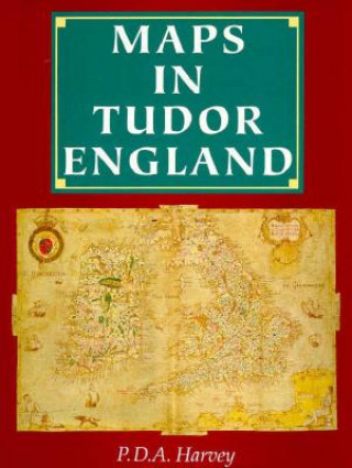
Maps in Tudor England
 Englisch
 159 b
159 b
 Demnächst
 Termin unbekannt
Bis zu 30 Tage Rückgaberecht
Kunden kauften auch




 /
/
 Broschur
 37.39
€
37.39
€






In the England of 1500 maps were rare objects, little used or understood. By 1600 they had become a familiar and practical part of everyday life, woven into tapestries, illustrating bibles, and even printed on playing cards. This century witnessed the invention of the map as we understand it today - a plan drawn to a defined scale, constructed by triangulation, and describing features of the landscape with conventional signs. In Maps in Tudor England, P.D.A. Harvey traces the revolution in production, understanding, and use of maps in England from 1485 to 1603. The Tudor period witnessed an explosion of cartographic development and proliferation: only a handful of English maps are known to have been created during the second half of the fifteenth century, whereas 800 survive from the second half of the sixteenth century. By the mid-sixteenth century, mapmakers had begun to draw maps to a consistent scale and reproduced the results of measured survey. By the end of the Tudor period, maps drawn to scale that showed features by conventional signs were well established and commonly used throughout England. Harvey focuses on maps of small areas, up to the size of a county, exploring their impact on the political and social life of England, with special focus on the military, government, towns, landed estates, buildings, and the law. Superbly illustrated throughout with thirty color and fifty black and white reproductions of rare maps, this account provides an informative and accessible introduction to a revolutionary period in the history of cartography, as well as a unique visual history of Tudor England.


Informationen zum Buch
Englisch

Verschenken Sie dieses Buch noch heute
Es ist ganz einfach
1 Legen Sie das Buch in Ihren Warenkorb und wählen Sie den Versand als Geschenk 2 Wir schicken Ihnen umgehend einen Gutschein 3 Das Buch wird an die Adresse des beschenkten Empfängers geliefertDas könnte Sie auch interessieren




 /
Broschur
31.89
€
/
Broschur
31.89
€







Hallo! Ich bin Libroamiko, dein Buchberater.
Wie kann ich dir helfen?